Amata Trail

Amata Trail: A Journey Through Latvia's Natural Beauty
Explore the breathtaking cliffs, riverbanks, and forest paths along the Amata River.
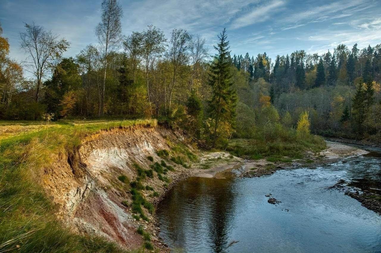
Within the Gauja National Park, 13 rivers flow into the Gauja River as well as many more small creeks and streams. The tributaries and small rivers throughout the Gauja National Park are fast-flowing rivers. The Amata River is the longest and one of the fastest flowing Gauja tributaries. The Amata Trail extends along the river’s right bank, offering the opportunity to get to know and enjoy the area’s unique nature. The clean currents, rapids and their banks are home to many of Europe’s rare species.
Overview
The Amata Trail in the Gauja National Park is an incredible place for walks and nature discovery, exploring one of Latvia’s deepest river valleys. The hiking trail invites you to discover the River Amata, one of the cleanest, roughest, and most rapid tributaries of the River Gauja. The river’s name is taken from the Livonian word “Amada” meaning “rapid”.
Distance: 21.5 km
Difficulty: Difficult (steep and high banks, deep ravines)
Best Time to Visit: April – October
Route: Melturi – Kārļamuiža – Kārļi – Zvārte Rock – Veclauču Bridge
Estimated Duration: 8–11 hours
Highlights of the Trail
- Primeval Valley of River Amata – One of Latvia’s deepest river valleys (up to 50m deep).
- Dolomite & Sandstone Cliffs – Unique geological formations from the Devonian Period.
- Diverse Flora & Fauna – Spot rare butterflies, dragonflies, and beaver traces.
The Amata Trail is an excellent location for hiking, relaxation and nature studies. The River Amata flows through an ancient valley with steep (up to 50m high) sandstone and dolomite banks. The banks allow us to examine the past of planet earth as far as 350-400 million years ago when the area of Latvia was covered by the sea. The 12-21km long trail and 6-8-hour long walk will allow you to enjoy the purity of nature and rock formations from the Devonian period. The ancient valley of the Amata is one of the deepest and most unique of Vidzeme’s river valleys.
Safety Tips
- Wear suitable hiking footwear.
- Beware of steep slopes and possible landslides.
- Do not climb on the cliffs or damage the environment.
- River crossings may be possible when water levels are low.
- Roči Forest Reserve: Entry prohibited beyond Zvārte Rock.
- Emergency Number: 112
Nearby Accommodations & Services
- Gauja National Park Visitor Centre, Zvārte Rock +371 2933544
- Karlamuiza Country Hotel, Kārļi +371 26165298, www.karlamuiza.lv
Trail Map: waypoints, cliffs, and scenic viewpoints.
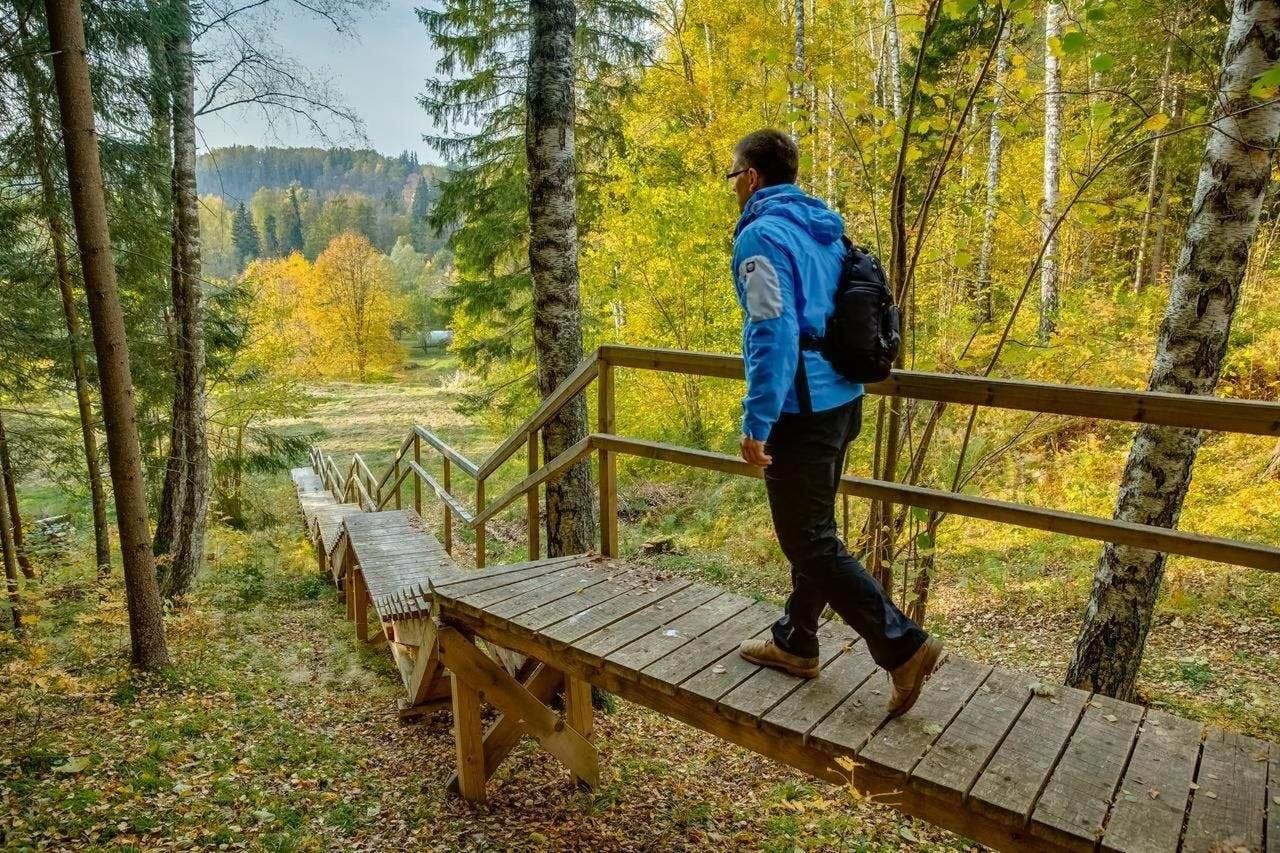
How to Enjoy the Amata Nature Trail
Discover the Amata Trail, one of the most scenic and geologically rich hiking routes in Latvia. The trail follows the right bank of the River Amata, beginning at the Vidzeme highway bridge near Melturi and ending near the Veclauču Bridge along the Kārļi–Līgatne road. Choose between independent hiking or join a guided tour to learn more about the area's unique natural features, Devonian rock formations, and cultural history.
Please note: The Amata Trail is not suitable for bicycles.
Recommended Trail Sections
1. Melturi Bridge to Kārļamuiža (4 km, ~ 2-3 hours) - The route is walkable in both directions
Starting at Melturi Bridge, this moderately challenging but well-marked section of the Amata Trail follows the right bank of the River Amata toward Karlamuiza Country Hotel. The trail leads above scenic cliffs with panoramic views over the ancient valley and winds through diverse forest landscapes. Marked with orange blazes, the trail is safe, natural, and enjoyable.
The route is walkable in both directions and is suitable for hikers of different experience levels — from nature lovers looking for a peaceful forest walk to more seasoned hikers who enjoy exploring natural terrain.
Trail highlights:
- Īļaku Rock (57.22486, 25.2262) – 100 m long and up to 25 m high dolomite cliff.
- Vizuļu Rock (57.22504, 25.22362) – Sandstone-dolomite outcrop with springs and winter icefalls.
- Dolomītu Cliff (57.22725, 25.22446) – 25 m high with distinct Devonian layers.
- Dambja Rock (57.23278, 25.21168) – Tall cliff with upper sandstone and dolomite formations.
- Amata Valley – One of the most striking river valleys in Latvia (up to 50 m deep).
- Karlamuiza Country Hotel(57.24023, 25.21254) – Excellent endpoint with rest, meals, and connection to other trail sections.
Look out for: Ball-shaped sandstone, beaver activity, woodpecker markings, and ancient river terraces.
2. Kārļamuiža – Ainavu Cliff – Stūķu Rock – Kārļamuiža (8.5 km, ~3–4 hours) - The route is walkable in both directions
Tip: The trail surface is mostly natural, with roots, stones, and occasional climbs, so sturdy footwear is recommended.
Route overview:
- Start and end at Kārļamuiža Country Hotel (25.21254, 57.24023)
- Wind through Kārļamuiža landscape park
- Follow Amata’s right bank from Ainavu Cliff to Stūķu Rock
- Return via a forest trail
Trail highlights:
- Ainavu Cliff (57.23884, 25.19989) – 0.5 km long and up to 46 m high with stunning panoramic views.
- Ķaubju Rock (57.23476, 25.19242) – Up to 45 m high, one of the tallest cliffs in Latvia.
- Stūķu Rock (57.23414, 25.17763) – 40 m high cliff with 15 m sandstone outcrop.
- Kārļi Fish Breeding Farm (57.23704, 24.19922) – One of Latvia’s oldest, preserving trout and salmon populations.
Did you know? This area has high biodiversity: butterflies, dragonflies, rare beetles, and unique flora thrive here in spring and summer.
3. Zvārte Rock to Veclauču Bridge (3.5 km, ~1–2 hours) – Family-Friendly Walk - The route is walkable in both directions
The easiest and most accessible section of the Amata Trail begins at the Zvārte Rock Visitor Centre and ends at Veclauču Bridge. Perfect for families and casual hikers.
Trail highlights:
- Zvārte Rock (57.24601, 25.14279) – 200 m long and 44 m high, with stunning views and river modifications to protect the cliff.
- Migla Rock (57.24672, 25.14575) – 8–12 m high, lush in summer.
- Čūsku Rock (57.24787, 25.14515) – Small outcrop behind the suspension bridge.
- Zemais Rock (57.25520, 25.13661) – With multiple natural caves.
- Lustūzis (57.25648, 25.13916) – Small yet visually striking outcrop, dangerous for paddlers during spring floods.
- Vanagu Rock / Roču Rock (57.25692, 25.13662) – Up to 300 m long and 36 m high, with springs and cave formations.
- Vizbulīšu Cliffs (57.25794, 25.14085) – Sandstone outcrop with a deep cavity.
- Palu Rock (57.25885, 25.14179) – Small but scenic outcrop.
- Zaļais Rock (25.13735, 57.26152) – Long and low sandstone cliff near the trail’s end.
- Veclauču Bridge (57.26131, 25.13698) – Rest stop with a beautiful river view.
Note: Expect large boulders in the riverbed and excellent birdwatching opportunities.
Plan Your Visit
Whether you're an experienced hiker or a casual nature lover, the Amata Trail offers a memorable experience through Latvia's geological wonders and scenic river landscapes. Combine your hike with a stay at the Karlamuiza Country Hotel, the perfect base for exploring all trail sections.